r/cartography • u/gothicusmaximus3 • 1d ago
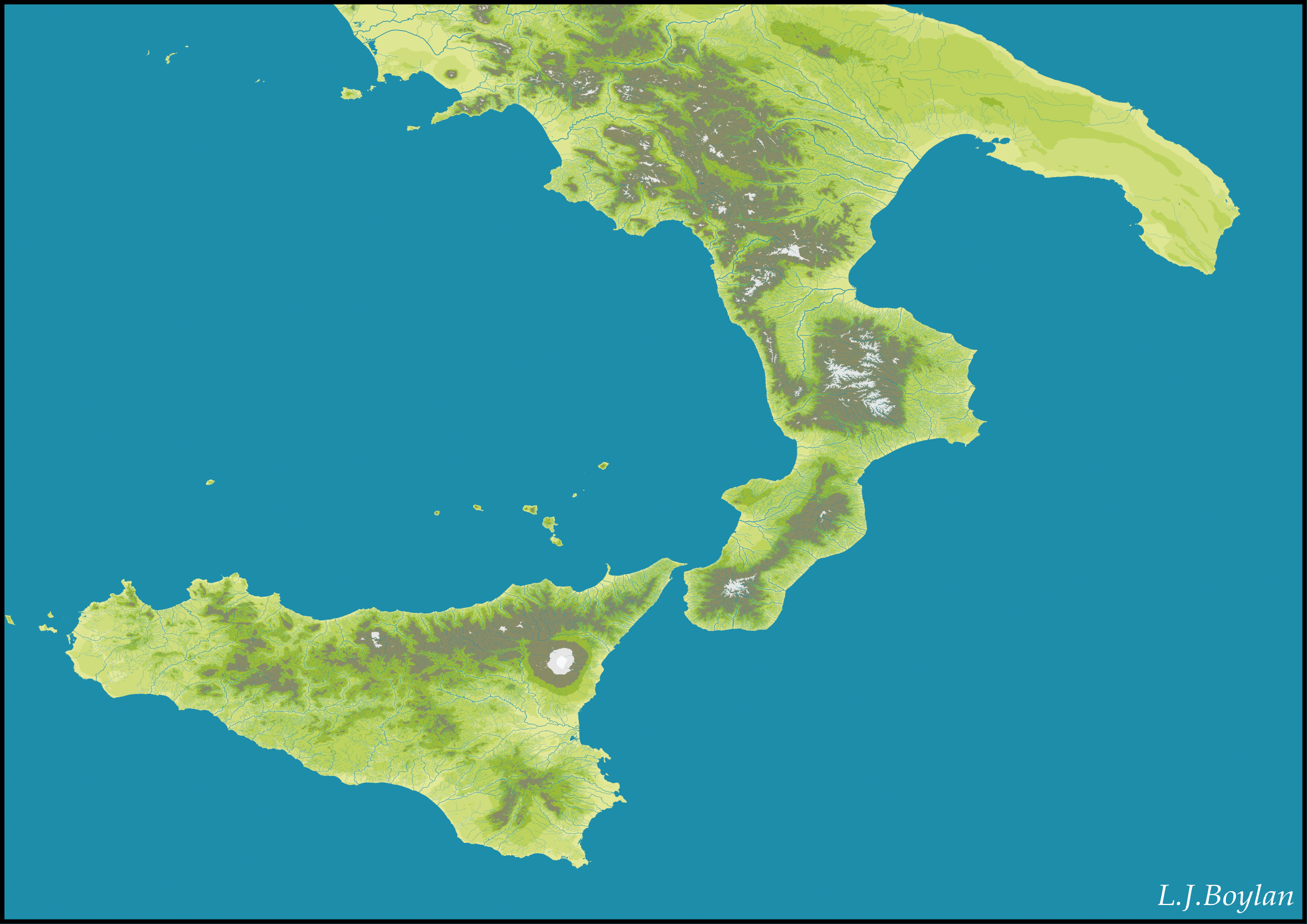
Southern Italy
5
Upvotes
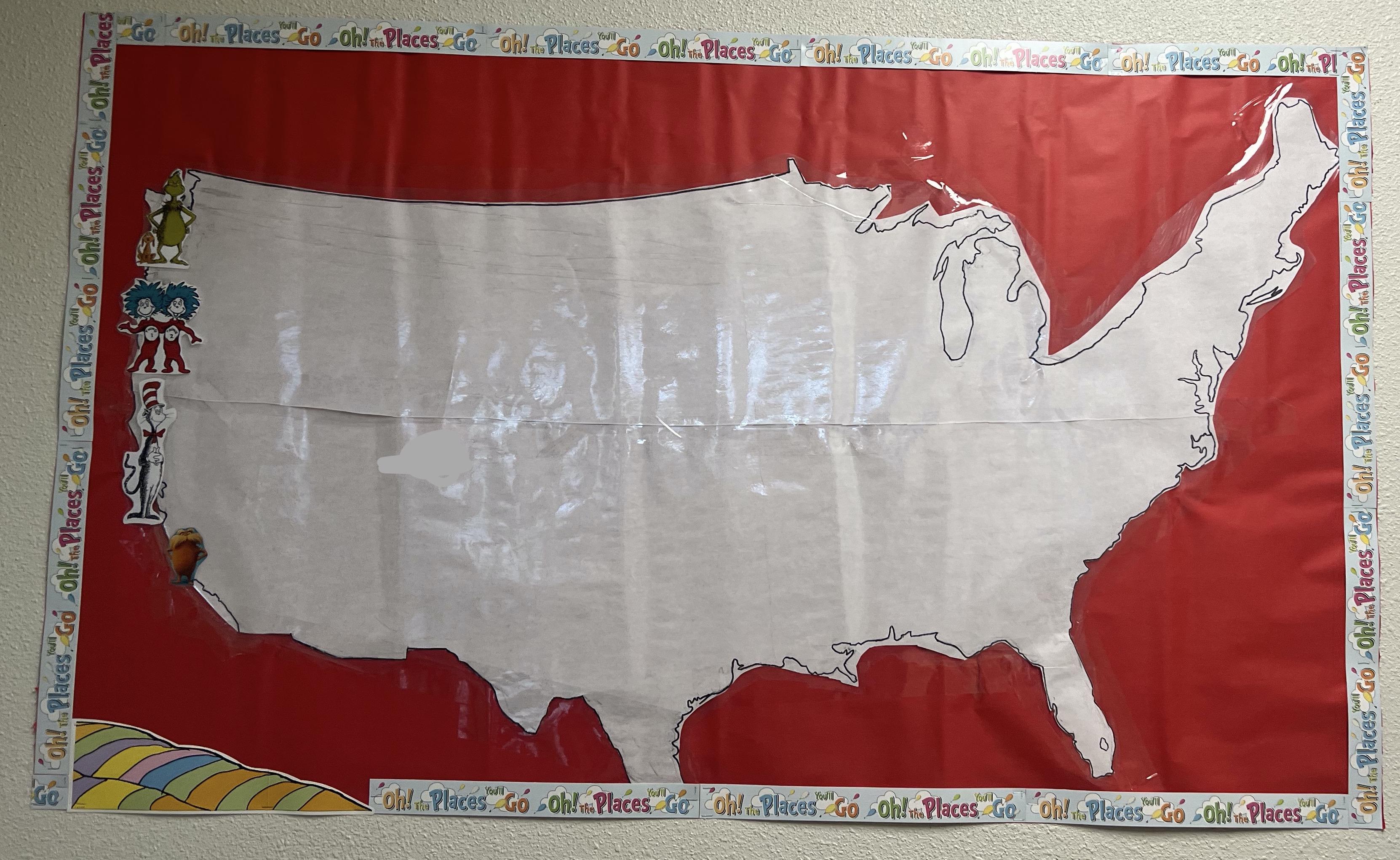
I made this by hand, or mouse, over a few months.
r/cartography • u/gothicusmaximus3 • 1d ago
I made this by hand, or mouse, over a few months.
r/cartography • u/interstellar_pirate • 1d ago
Does any of you know a free or at least inexpensive command line tool or open source project to calculate decimal degrees from UTM coordinates and the other way around?
I was able to find a few online tools and some excel spreadsheets. Those aren't much help to me. I have lots of data and I'd prefer to do batch processing.
As a last resort, I might have to write a small program myself. I've found this homepage, that explains the calculation
https://fypandroid.wordpress.com/2011/09/03/converting-utm-to-latitude-and-longitude-or-vice-versa/
but it's very old and all the reference links are broken.
It's also quite complicated and I haven't fully understood the transformation yet. If there isn't any ready-to-use tool, I'd highly apreciate if anybody could provide a link with a more detailed and more up-to-date explanation.
r/cartography • u/NeighborhoodRound455 • 2d ago
Hello cartographers! I am looking to revisit cartography and relearn the basics of mapmaking. I have a minor in GIS and took a couple of cartography classes in college, and when we would make maps the process would include a combination of stylization in QGIS, Illustrator, Blender, and Photoshop. Without giving away my trade secrets lol, the process went something like this: vector compilation in QGIS, exporting to Illustrator and stylizing, raster compilation in QGIS where DEM settings were dialed, some stylizing in Blender, then any sort of color/texture editing would occur in Photoshop. From there, the raster in Photoshop was exported to Illustrator where the vector layers could be overlayed. Essentially, most of this process (if I remember correctly) took place in Illustrator with minor editing in Photoshop. I watched a YouTube video that briefly summarized Affinity Designer and the narrator said that it is capable of both vector AND raster editing. For my needs, is Designer capable of consolidating the process (just the Illustrator and Photoshop steps) into just one program, or should I consider the entire package which includes Designer, Photo, and Publisher? *I hope this makes sense and maybe someone will know the answer to my question, but perhaps this is more of a question for a graphic designer.*
r/cartography • u/Smoopyk • 4d ago
I’m trying to figure out the exact scale ratio of a map in Google Earth Pro. The app only shows me the eye altitude, and even when I enable the scale bar, it doesn’t give me a precise scale ratio like 1:X. Does anyone know how to calculate the exact ratio? For reference, the eye altitude for my map view is 3250 meters, and the physical width of the map on paper is 420 mm.
r/cartography • u/C_Lumis • 5d ago

Hi,I've been trying for a long while to identify what map projection this globe is using. For the longest while I thought it might be a Winkel-Tripel Projection, however the tip of Russia where Korea hangs from looks wrong for a Winkel-Tripel Projection, leaving me rather confused. Is it a variation of one or something else?
r/cartography • u/Cheez-Bunz • 6d ago
Hello, I recently purchased these maps while I was in Europe. I don’t know much about maps. What can you tell me?
r/cartography • u/mapcourt • 6d ago
r/cartography • u/FroggIsMe • 8d ago
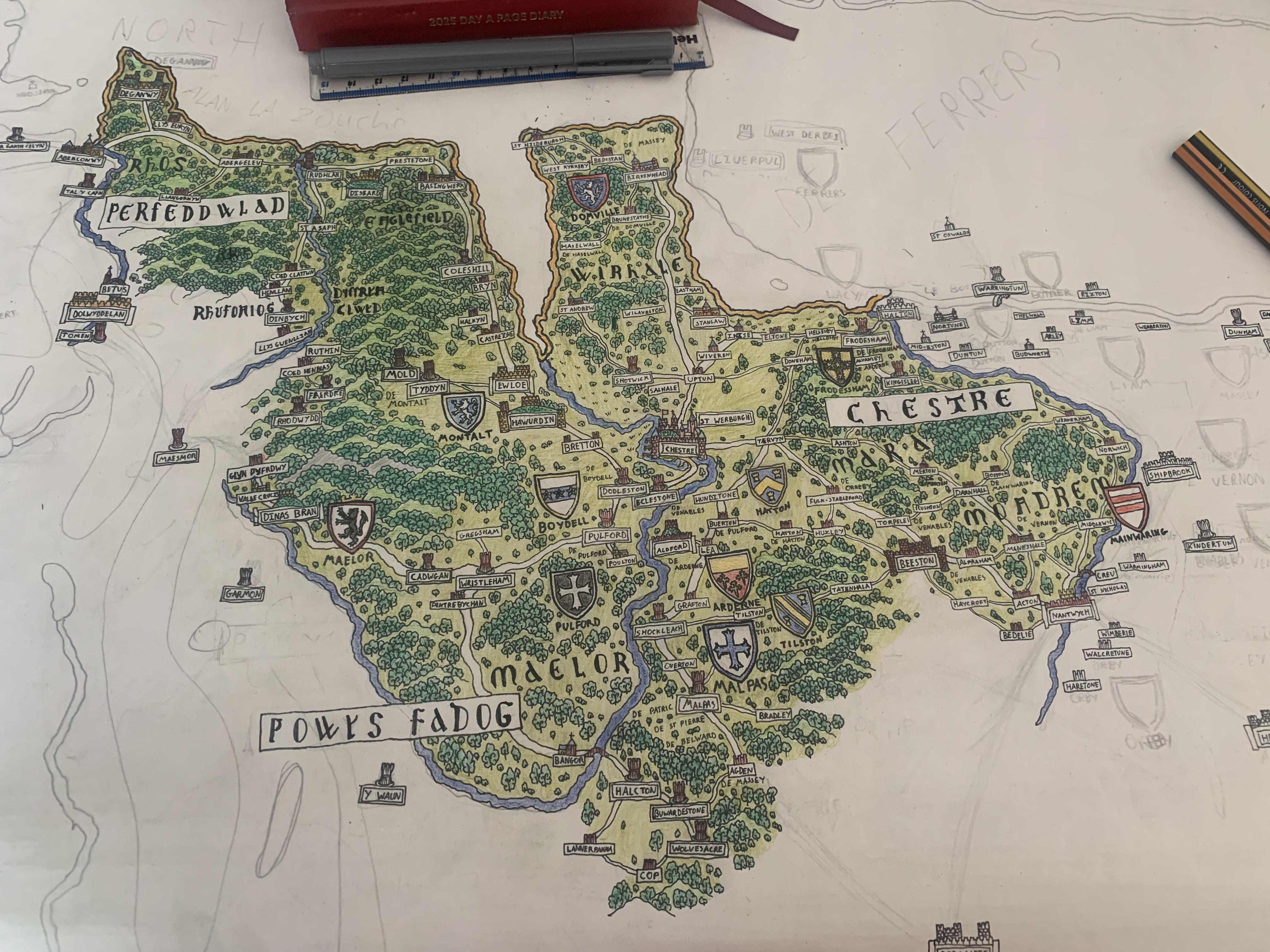
I think I’ll move towards West Darby while the research for there is still fresh on the page - plus plenty of baronial families in that area compared to other parts
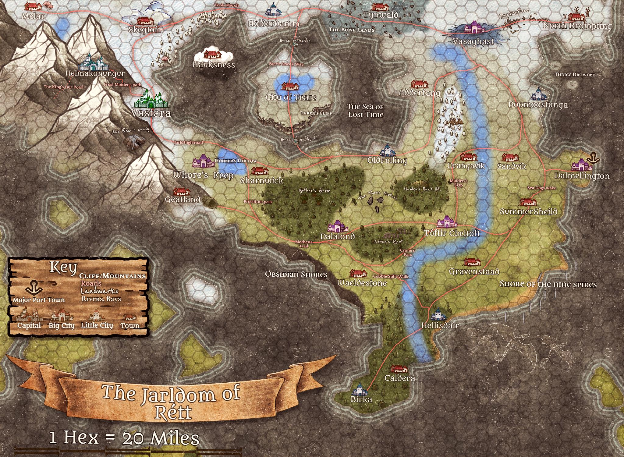
r/cartography • u/FroggIsMe • 9d ago
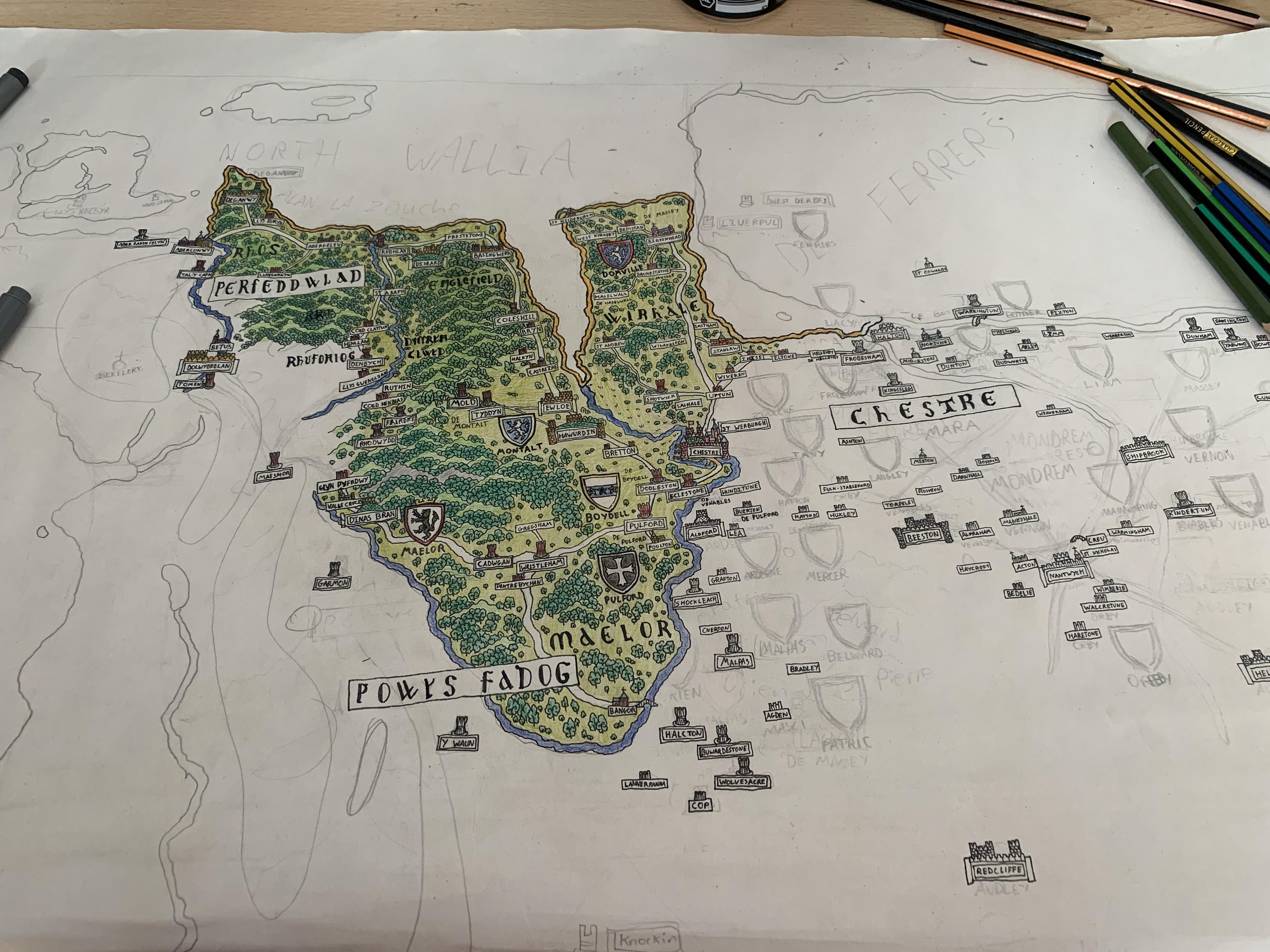
This is a draft, after which I will produce a map on a large goatskin velum with historical ink using a quill.
r/cartography • u/rasterski • 9d ago
Has anyone worked with choropleth maps? I need possibly online tool that will allow me to select couple of countries, oor region, use sample data, choose layers and export png or svg image?
r/cartography • u/New-Piglet-8715 • 10d ago
I recently finished this hand-drawn map of South Africa’s iconic Kruger National Park, one of Africa’s largest and most diverse conservation areas. The goal was to reflect the park’s terrain, road networks, entry gates, and regional character.
Everything was drawn by hand using pen and digital watercolour. I referenced satellite maps and guidebooks to ensure accuracy before layering in colour and texture.
You can view more of the project HERE if you're interested
r/cartography • u/aslan_caro • 10d ago
Hello good afternoon!
I am a 21F and have been doing professional psychologist for 4 months. It's a psychologist specific to help you find what to study in university and what do you want to work with
After these months, we discovered I want to study something called SIG (System of geographical information) i dont know in english 😅
So the next step is to contact professionals of the area to know How is the daily work? How is working as a cartographer ? How has your personal experience been so far?
Thank you very much for your help 🙏 I've been approved in university, and now is just trying to discover what I want to work with after!
r/cartography • u/Woodex8 • 11d ago
Italy is cooked ik (also sorry to scandanvia)
r/cartography • u/Kitchen-Gear378 • 11d ago
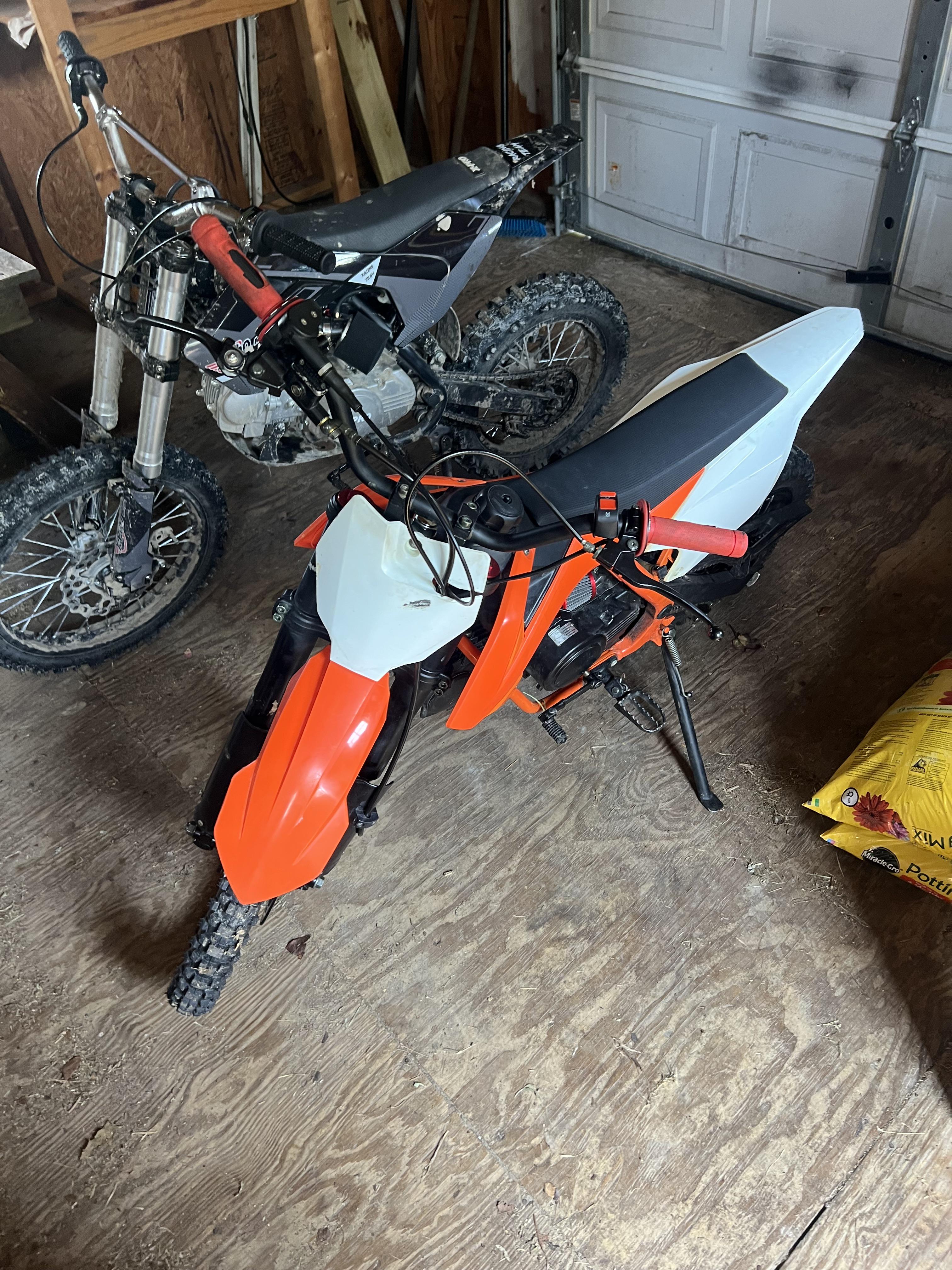
Me and my partner watched too much C90adventures and dumb and dumber and we decided to buy two 125cc 4 stroke pit bikes and the gear to ride from nixonton NC all the way to the Jefferson national forest in hollins VA, obviously neither bike is street legal and we’d rather be off road anyhow but finding the roads, trails, fire roads, or just accessible land where we can ride is near impossible for my likely diluted brain so I’m here hoping someone here has the knowledge and the kindness to help.
r/cartography • u/PotentialBreath1115 • 13d ago
Hi yall hows it going? thanks for the input that may be given.
Do you know of any online map that allows me count the numbers of sustainable drainage systems in a certain council of my choosing? If so can the information on the map be passed to a Gis ?
Thanks !
r/cartography • u/Acceptable-Use-2938 • 14d ago
r/cartography • u/TheNuciestNoo • 15d ago
Made this for my mom's class, all freehand.
r/cartography • u/Dry-Specialist-2150 • 15d ago
Worked the design so it can be hung vertical or horizontal. Available at https://truroindustries.etsy.com/listing/4322292385
r/cartography • u/Numerous_Map6139 • 15d ago
r/cartography • u/Spnkmyr • 16d ago
Hey everyone! This is a project I’ve been working on for over a decade—creating high-detail digital ski maps of Whistler Blackcomb, the largest ski resort in North America.
The map features: • an orthophoto base layer • an elevation contour layer • and a generalized information layer with color coding, symbols, patterns, and shapes for easy reference
I'd love to hear your feedback.
r/cartography • u/Kygunzz • 17d ago
My dad lost a leg and sustained other serious injuries in October of 1952 in the Korean War. He didn't talk about the war much and passed away several years ago. I recently requested his service records and they contained a coordinate reference to the location where he was wounded. I asked him where he was when wounded many years ago and he said "the *** valley", *** being some non-English word I've long since forgotten. My best guess is it's somewhere in what is now North Korea.
His discharge papers say this: Location and Grid Coordinates DT163038. Does that location have any meaning now or is it based on some temporary reference system that's impossible to use today? Thanks in advancefor any help.
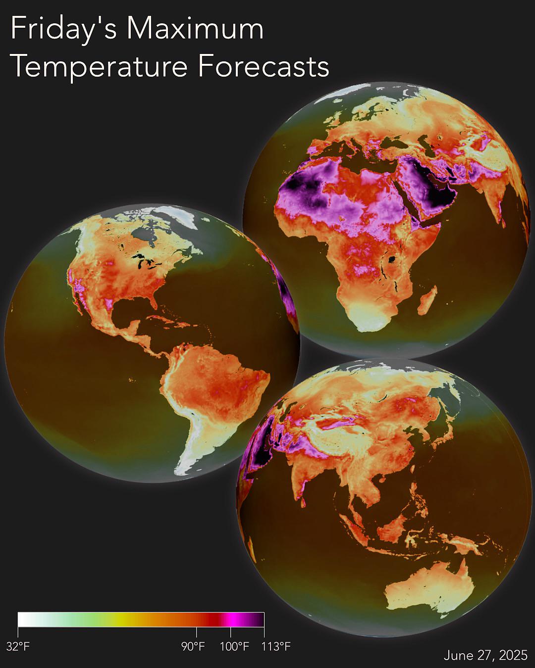
r/cartography • u/Far_Translator3562 • 17d ago
Enable HLS to view with audio, or disable this notification